Planetary Data
| Radius | 7 x 10⁶ m |
| Mass | 7.203 x 1024 kg |
| Density | 5.52 x 10³ kg/m3 |
| Gravity | 1.1 g |
| Surface Area | 6.158 x 10¹² m2 |
| Land Area | 1.540 x 10¹² m2 |
| Water Area | 4.619 x 10¹² m2 |
The sun that mycle orbits around is a G2 sun like Sol. I can't find what I named the sun but when I find it I'll put it here.
A day on mycle is 22.5 earth hours long. The year 392 mycle days long. This gives 14 months at 28 days each.
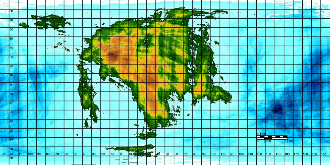
World Map of Mycle
Map of the 15 Nations
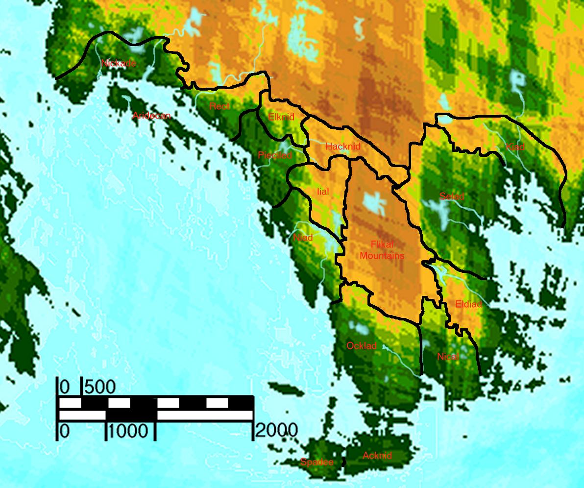

Well the map in this form isn't very good. I've had to shrink it down a bit to save on disk space, but I do have the original. But here's the list as best as I can describe it.
In the top left is Nickade.
The two islands below it is Aridecan.
To the east along the shore is Rect.
Southeast along the shore is Pieciled
North of Pieciled and east of Rect is Elknid.
To the east of both Pieciled and Rect is Hacknid
East of Hacknid is Selad
North of Selad is Kiad
South of Hacknid and South east of Pieciled is Iial
South of Iial is Niad
Southeast of Niad and along the southern shore is Ocklad
The island south of Ocklad is split into two. One the west side is Spadee, to the east of Spadee is Acknid.
To the east of Ocklad and moving up the southeastern shore is Nical.
The final nation to the north of Nical and south of Selad along the shore is Eldaid.
The mountains in the center of the continent between almost all the nations is are the Flikal Mountains.